In 2002 the United States Postal Service discontinued ZIP code 17927. The Postal Bulletin recorded it in one row: "Post Office and ZIP Code discontinued." The post office itself had been suspended since 1994. About twenty people were still getting mail in Centralia, Pennsylvania. The Postal Service folded them into Ashland's 17921, down the road, and let them keep the town's name on the envelope. Ashland is not on fire.

Centralia has had a coal fire under it since May 1962. The 1960 census counted 1,435 people there; the state's chronology puts the 1962 population at 1,100. The 2020 census counted five, and the last residents have an arrangement with the state. The fire started as a cleanup.
The Cleanup
Centralia sits in the anthracite field of eastern Pennsylvania, over coal the state says was first mined in 1842. By 1962 the big companies had taken what paid and left. The tunnels stayed, and so did the pillars of coal left behind to hold the roof up. Anthracite is the hard kind. Once it's lit, the state says, it can smolder on 1 to 2 percent oxygen.
Every spring before Memorial Day, Centralia burned its town dump so that people visiting the cemeteries wouldn't have to smell it. By David DeKok's account, a 1958 state law had banned dump fires because they could set the mines alight. In 1962 the dump was new: an old strip-mine pit just outside the borough line, beside the Odd Fellows Cemetery.
The council met on May 7 and hired five volunteer firemen to clean it up. The minutes don't say how. On Sunday, May 27, they set the rubbish alight and hosed it out that night. Two days later it was burning again; by the fire chief's account, someone drove to Ashland for 500 more feet of hose. It flared again on June 4. Under the rubbish, at the base of the pit's north wall, was a hole about fifteen feet wide that should have been sealed with something fireproof.
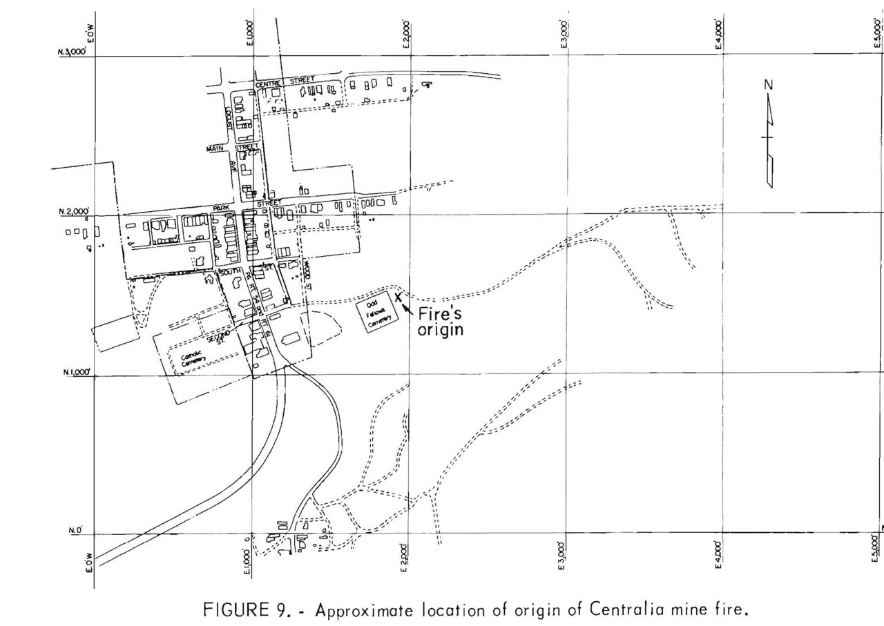
The state calls the dump burn the "most widely accepted ignition scenario," and in DeKok's account the fire followed that hole into the old workings. Other accounts blame hot ashes dumped the day before, or an older mine fire. The borough had its own account. A letter it sent on July 26, cited in the journalist Joan Quigley's notes, blamed "a fire of unknown origin" that started "on or about June 25, 1962 during a period of unusually hot weather."
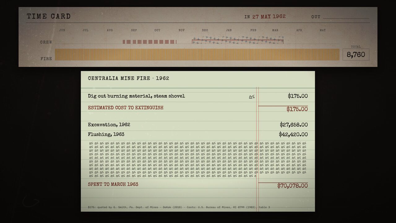
By then the fumes from the pit were drifting into town, and the pastor of St. Ignatius had complained that the smell reached his church. That summer a state mine engineer, Gordon Smith, offered to dig out the burning material with a steam shovel. He quoted $175, a little under $2,000 today. In August the state took over.
Eight-Hour Shifts
Federal help would have taken about three months to approve, the Bureau of Mines recorded, so the state went ahead alone and took bids without advertising. It hired Bridy, Inc., of Atlas, near Mount Carmel, to dig the fire out for about $20,000. The contract ruled out exploratory drilling, which meant nobody could find out how far the fire had already gone. The crew worked eight-hour weekday shifts, with the usual holidays off. That included Labor Day weekend.
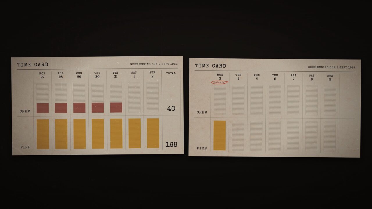
Every time the small shovel broke into an old mine chamber, air rushed in and fed the fire. On October 23 the deputy secretary of mines reported that "the fire had advanced beyond the excavation." Work stopped on the 29th, after 53,580 cubic yards against the 24,000 planned. The bill was $27,658.
The second contractor, K&H Excavating, started in November on a low bid of $28,400 to flush the tunnels with water and ground colliery waste. The water lines froze. The grinder froze in a blizzard. The bill came to $42,420. By April 1963 steam from new openings showed the fire 700 feet east of where it began; the Bureau of Mines measured its advance along the coal bed at 500 feet in eleven months.
In May, with the fire a year old and about $70,000 spent, or 400 steam shovels, the engineers priced three plans: a full trench around the fire for $296,290, a partial trench with a flushed barrier for $160,214, or more flushing for $82,310. The Bureau's report says the second was "considered the most practical," and that "State funds were not available." That summer the state dug a cheaper partial trench. By October there was fire on both sides of it.
Feet Per Year
Underground, the fire moves through the old workings at what the state calls an average of 50 to 75 feet a year, "depending on the particular fire front." The same FAQ describes the advance as "highly variable or uneven." More than 2,000 boreholes were drilled to find it, most of them outside the borough's 155 acres. From 1962 to 1978 the state and federal governments spent $3.3 million, with what the state's chronology calls "limited results." The Bureau of Mines, writing in 1980, was plainer: the fire "has not been extinguished and is not controlled."
On May 22, 1969, three families at Wood and South Streets had to leave their homes after state mine inspectors found too little oxygen and a trace of carbon monoxide in a cellar. Everyone else stayed. The fire kept coming, under the streets, toward the school, and under a gas station on Route 61.
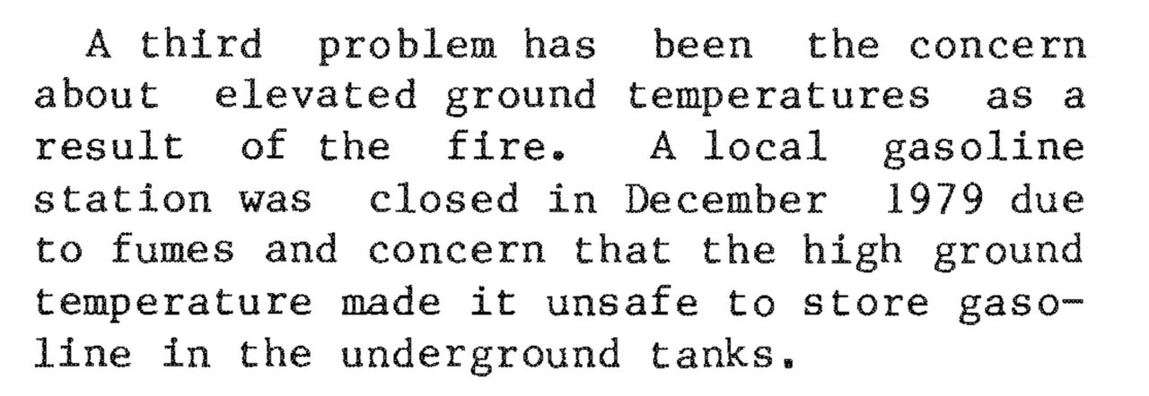
In December 1979 steam came up through the basement floor of John Coddington's Amoco station. A state inspector measured the floor at 136 degrees. When the cap came off a gasoline tank, the level inside rose a foot. The fire marshal had all 9,000 gallons pumped out and the tank filled with water. The station never reopened.
Valentine's Day
In the winter of 1981 the state offered gas monitors to every household in the impact zone, and 72 of 106 took one. They were industrial units built for deep mines, black boxes with a red bell, and they clucked about 70 times a minute. When an alarm went off, the official advice was to open the windows. That January one home's alarm sounded almost every other day. The statewide average temperature for the month was 19.2 degrees.
Gas had been showing up at St. Ignatius Elementary since 1980, and the town had split into what residents called the hot side and the cold side. Some wanted a buyout; their neighbors held that there was no fire under their street. For the time being, both were right.
On Saturday, February 14, 1981, a twelve-year-old named Todd Domboski was in a backyard in Centralia when the ground gave way under him. The hole was deeper than anyone could measure, and it was breathing steam. He caught a tree root and held on until his teenage cousin, Eric, pulled him out. Later that day a state inspector measured carbon monoxide in the hole beyond the scale of his detector.
Politicians touring the fire were in town that day, and the story went national. In March the former mayor, John Coddington, was overcome by fire gases, and the state's emergency management director persuaded Governor Dick Thornburgh to visit. He did; the State Archives keeps a silent film of the tour. By the end of the year 27 families had been bought out and moved, in a town of about a thousand. Their houses were marked for demolition with a red spray-painted "2," for the second relocation project.
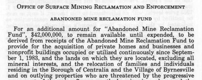
In July 1983 the federal Office of Surface Mining finished its study. Digging the fire out would cost $663 million and take a good part of the town with it. On August 11 the residents voted 345 to 200 to sell. On November 30 the appropriation, $42 million to buy and move Centralia and the village of Byrnesville, became law. None of it was for the fire.
The Last Generation
Between 1985 and 1991 the state bought 545 homes and businesses across the fire zone, at an average of about $52,000 a household, and knocked them down. More than a thousand people left. Byrnesville, the village down the road, went too. The state didn't buy the coal, because the law said not to, and the borough still claims it. In a 2010 court filing the residents and the borough put its value in the hundreds of millions of dollars; the state says no reputable body has ever calculated it. The state's lawyer said he knew of no document giving the borough ownership, and that it wasn't clear who did own it.
Not everyone sold. In the row houses, when a neighbor's half came down, the half that stayed had to be propped up with brick buttresses.
In 1992 Governor Robert Casey moved to take the remaining 53 properties by eminent domain. To explain what came next, the state rented the borough's own municipal building. The case that followed is titled In re Condemnation of the Surface of that Certain Tract of Land Located in the Borough of Centralia. The residents lost in the county court, the Commonwealth Court and the state Supreme Court, and on April 1, 1996, the U.S. Supreme Court declined to hear it. The borough sued separately, as owner of the coal, arguing that condemning the town amounted to taking the coal. It lost too.
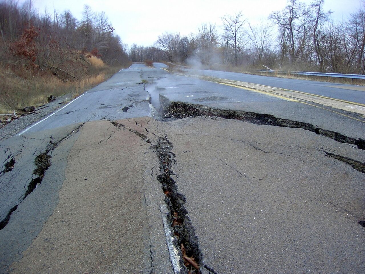
By 1983 the fire had eaten the coal pillars under Route 61, and the road began to sink. The state spent about half a million dollars shoring it up, then in 1993 closed about 4,000 feet of it for good. Over the years visitors, many from other states, covered the closed stretch end to end in spray paint, and it became known as the Graffiti Highway. In April 2020 the owner buried it under about 400 truckloads of dirt.
In 2009 the state began evicting the people who were left. They argued that the fire had moved on and that Centralia's air now matched Lancaster's. For mercury vapor, a 2008 state study had found the same reading as Lancaster's in 2005: 1.6 nanograms per cubic meter. In 2012 the courts turned them down again: a condemnation, once made, stays made. Lancaster was not condemned.

The Commonwealth spent thirty years and about $41.6 million in federal money getting people out of Centralia. In October 2013 it settled with the seven who were left, eight by some counts. They got $349,500 between them: $218,000 for the houses the state had taken in 1993, and $131,500 to settle their other claims. They also got the right to stay in their houses for the rest of their lives. When they die, the houses go to the state, which has owned the ground since 1993.
Frequently Asked Questions
The Pennsylvania Department of Environmental Protection still has the file. Its FAQ says it inspects the surface monthly and checks the boreholes yearly. Its only published temperature log, from the summer of 2011, reads: borehole N-10, 170 feet, 403 degrees. N-70, "Inaccessible, concrete in borehole." N-12, "Inaccessible cap, needs cutting torch." N-41, "Could not be found in field." In the 1970s and '80s the surface, in places, measured 900 degrees. By January 2012 the fire had involved about 400 surface acres. The borough is 155.
The FAQ runs to 113 questions and was last modified on June 7, 2013. "Can people buy property and build in Centralia Borough?" The answer is "No." The last question in the document asks for directions; the state "does not provide directions to, or recommend the touring of, hazardous abandoned mine sites." Nobody, it says, really owns the "Fire." Asked whether rare and unique forms of life live around the surface vents, it notes that researchers have found "unique, rare and exotic forms of life" where volcanic gases vent, and that coal-fire vents "could allow for similar opportunities." It gives the same answer, with the nouns changed, about minerals. In 2017 microbiologists reported that the hottest soils over the fire, which can pass 176 degrees, hold the most distinct bacterial communities. We've filed that as a yes.
Left uncontrolled, the FAQ estimates, the fire could burn for over 100 years; Smithsonian reported an estimate of 250 in 2005. "As of January 2012," it says, "there are no State initiated plans for the future of the fire or the surface above the fire in Centralia Borough." The FAQ counts about 38 coal mine fires burning in Pennsylvania. The state's current table, from August 2025, lists 45: 22 confirmed burning, 16 dormant and 7 out. The one at Laurel Run, in Luzerne County, has been burning since 1915.
Still a Borough
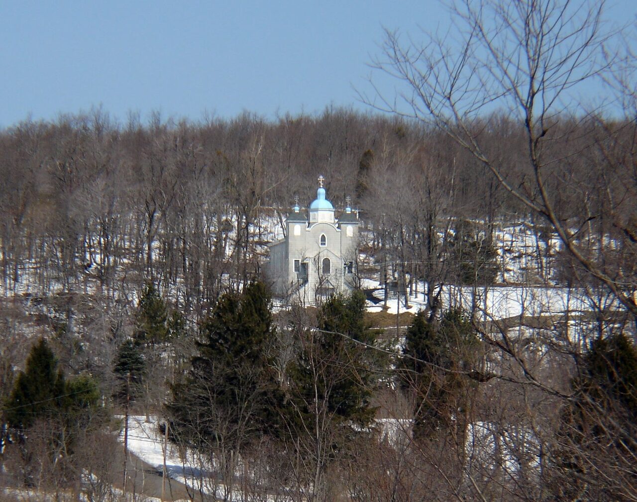
One church is left: the Assumption of the Blessed Virgin Mary, Ukrainian Catholic, on the hill above town. The parish was founded in 1911, and the cornerstone says 1912. A survey found the church sits on solid rock rather than coal. By the Census Bureau's map, it stands a few dozen meters outside the borough line. It holds Divine Liturgy every Sunday at 10:30. In November 2015 the head of the Ukrainian Greek Catholic Church, Major Archbishop Sviatoslav Shevchuk, visited and designated it a pilgrimage site. Centralia lost its ZIP code and became somewhere people travel to on purpose.
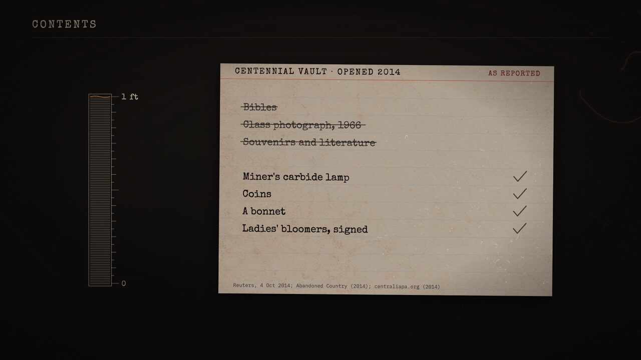
In 1966, for its centennial, the town buried a time capsule under the American Legion lawn, to be opened in 2016. It was sealed in a child's burial vault. In May 2014 somebody tried to dig it up, so it was opened that October, two years early, with about 75 people there. There was about a foot of water inside. Nothing made of paper had lasted, including the Bibles and a 1966 class photograph. A miner's carbide lamp, some coins, a bonnet and a pair of ladies' bloomers, signed by the men of the town, had. They went back to the families.
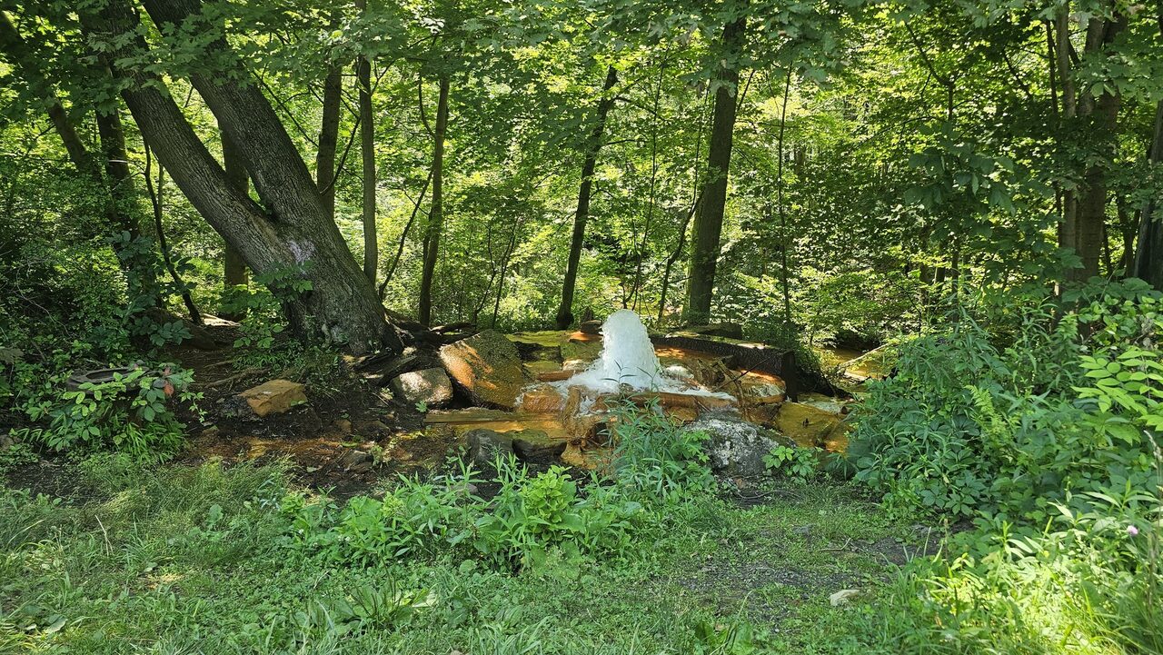
Near Ashland, water from the flooded mines comes up through an old ventilation borehole hard enough that it's called Pennsylvania's only geyser. It's cold, around 50 to 55 degrees. It erupts on private land, and nobody caps it, in case the water comes up in people's basements instead.
The borough still exists; the Census Bureau lists it as an active government. In June 2026 a state audit found its 2024 road money compliant "in all significant respects," after two corrections. The auditors also noted a one-cent deposit, made on January 23, 2024, to correct a balance discrepancy. In February 2011, by the Pottsville Republican's account of a council meeting, the month's largest bill was $92, for the town's Christmas lights, and the budget was in the black.
The Postal Service has not given 17927 to anyone else.
Sources & Case References
- Pennsylvania DEP — Centralia Mine Fire Chronology
- Pennsylvania DEP, Bureau of Abandoned Mine Reclamation — The Centralia Mine Fire: Frequently Asked Questions/Answers (2013)
- Pennsylvania DEP — Centralia Temperature Monitoring (revised August 10, 2011)
- Pennsylvania DEP — Centralia Mine Fire Mercury Study, Final Report (2008)
- Pennsylvania DEP — PA Underground Coal Mine Fires (rev. August 2025)
- U.S. Bureau of Mines — Report of Investigations 8799, Problems in the Control of Anthracite Mine Fires: A Case Study of the Centralia Mine Fire (August 1980) (1983)
- Public Law 98-181, 97 Stat. 1294 (November 30, 1983)
- USPS Postal Bulletin 22093 (January 9, 2003)
- Pennsylvania Department of the Auditor General — Borough of Centralia, Liquid Fuels Tax Fund, 2024 (June 2026)
- David DeKok, Unseen Danger: A Tragedy of People, Government, and the Centralia Mine Fire (1986) and Fire Underground (2010); chapter 16 of Unseen Danger, posted by the author
- Joan Quigley, The Day the Earth Caved In (2007), and her chapter notes
- J. Stephen Kroll-Smith and Stephen R. Couch, The Real Disaster Is Above Ground (1990)
- Congressional Record, July 23, 1981, reprinting the New York Times, "Pennsylvania Town Lives With Fire That Won't Stop" (March 28, 1981)
- UPI — "Smouldering coalmine gradually swallowing Centralia" (August 27, 1981)
- David DeKok — "Government was slow in helping residents," The Patriot-News (May 27, 2002)
- Wikipedia, "Centralia, Pennsylvania": revision of November 9, 2005 and revision of March 8, 2007
- Pennsylvania Trails of History (PHMC) — 1981 film of Governor Dick Thornburgh's tour of Centralia, Pennsylvania State Archives
- UPI — "Last residents living over mine fire ordered to abandon town" (February 20, 1992)
- AP — "Pennsylvania coal town above mine fire claims massive fraud" (March 9, 2010)
- Patriot-News — "Court denies Centralia property owners looking to keep their homes" (February 23, 2012, archived)
- AP — "Pa. residents living above mine fire free to stay" (October 31, 2013)
- WITF / PennLive — "Centralia's 'Graffiti Highway' is finally getting erased" (April 7, 2020)
- Lee et al., The ISME Journal 11 (2017), on the soil bacteria over the Centralia fire
- Smithsonian — "Fire in the Hole" (May 2005)
- NOAA National Centers for Environmental Information, Climate at a Glance: Pennsylvania statewide average temperature, January 1981
- Skook News (October 5, 2014) and Ben Swenson, Abandoned Country (updated October 2014), on the time capsule; WHYY (September 6, 2016), on the 2015 pilgrimage designation; Jim Cheney, UncoveringPA, and Islands (June 2026), on the Big Mine Run geyser
- Pottsville Republican — "'Regular borough council' in Centralia" (February 13, 2011, archived)
- Ukrainian Catholic Archeparchy of Philadelphia — Assumption of the Blessed Virgin Mary, Centralia
- Image credits: the 17927 bench, photo by James St. John, CC BY 2.0, via Wikimedia Commons; the Big Mine Run geyser, photo by JJonahJackalope, CC BY-SA 3.0, via Wikimedia Commons; the church on the hill, photo by Mredden, CC BY-SA 3.0, via Wikimedia Commons. The photographs are cropped and toned as they appear in the film.
- Public domain, courtesy the U.S. Bureau of Mines (Report of Investigations 8799, figure 9 and page 41) and the United States Congress (Public Law 98-181, 97 Stat. 1294). The Route 61 photograph is by JohnDS, released into the public domain. Unmarked figures are frames from the film.